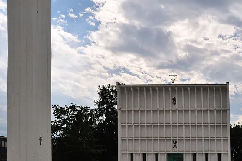
Steinkjer Church
Consecrated in 1965 to replace the church destroyed in the bombing of April 1940, this concrete and brick basilica seats 600. Its free-standing bell tower rises 38 m; inside are Jakob Weidemann's blue stained-glass windows.
All guides › Trøndelag › Steinkjer · County news · What's on
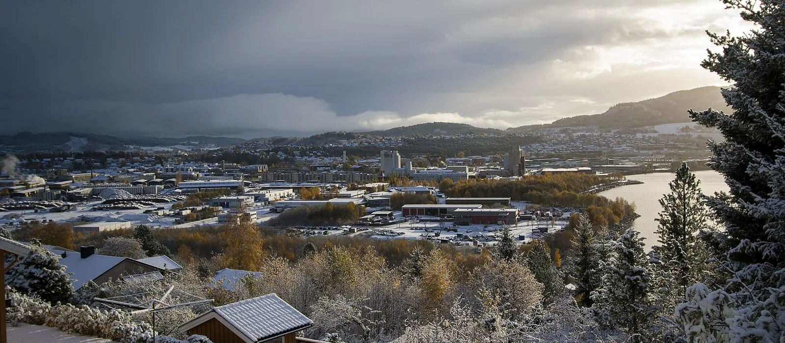
At the head of the Beitstadfjord, a small town rebuilt after the bombing of April 1940, surrounded by rock carvings, burial mounds and forests. Every piece of information is checked at the source.
Information checked on 12 October 2026.
Consecrated in 1965 to replace the church destroyed in the bombing of April 1940, this concrete and brick basilica seats 600. Its free-standing bell tower rises 38 m; inside are Jakob Weidemann's blue stained-glass windows.
Opened on 2 September 2023 in the town centre: cinema, a three-storey library, gallery, workshops and the "Steinkaret", an immersive experience room, the first of its kind in Norway. Café on site.
Jakob Weidemanns gate 1, 7713 Steinkjer · steinkjerkulturhus.no
An open-air museum founded in 1994 on the Egge estate, 860 hectares above the town: a complete 19th-century farm, the county governor's residence completed in 1919 and some fifty burial mounds raised between about year 0 and 1000. Open mainly in summer and for events.
Egge allé 70, 7715 Steinkjer · eggemuseum.no
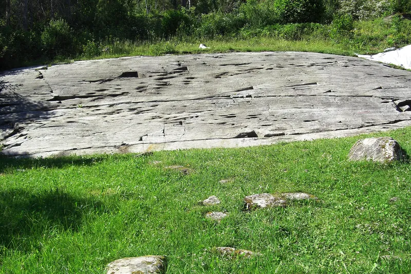
At Sør-Beitstad, near the centre, more than 400 figures carved into 300 m² of rock: animals hunted in the Neolithic, including a six-metre whale, then, on top of them, large Bronze Age boats. One of Trøndelag's largest sites, freely accessible.
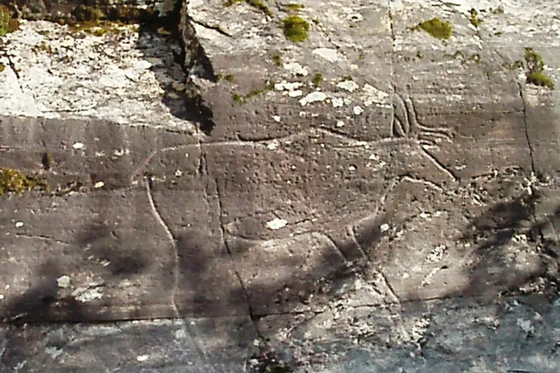
On the southern shore of Lake Snåsavatnet, some thirty figures carved about 6,000 years ago, including a remarkably well-preserved life-size reindeer; a skier, the "Bøla man", was found there in 2001.
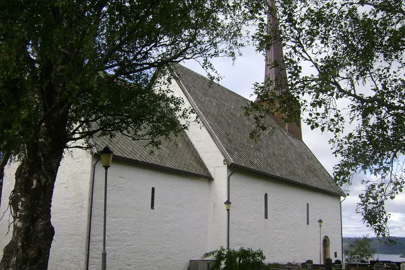
A medieval stone church built between 1150 and 1200 on a hill at Sparbu, over a 7th-century pagan cult building uncovered by excavations. It keeps exceptionally old furnishings, including a crucifix that may date from the 13th century.
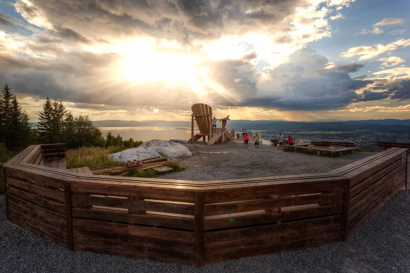
Steinkjer's highest point (336 m), 4 km south-east of the centre, with views over the town, the fjord and the Ogndal valley. A 4.75 m garden chair has stood at the top since 2013; a troll trail lined with wooden sculptures is popular with families.
A cairn marks the middle of the country in the Ogndal valley, between Vakkerlifjellet and Lake Skjækervatnet. From Gaulstad a marked trail laid with sleepers leads there in about 9 km over easy ground: allow some 20 km round trip.
At Malm, north-west of the town, an iron mine discovered in 1906 and worked until 1997; its shafts went down nearly 1,200 m, the deepest in Northern Europe. The mine site is now a heritage park, Bergmannsparken.
The largest prehistoric grave field in former Nord-Trøndelag: nearly 120 graves around the Skei crossroads — round, long and star-shaped mounds, the biggest 17 to 20 m across, largely from the Merovingian period (500–800). Free access.
7 km south of town along the E6, Norway's largest Bronze Age grave field (1800–500 BC): 47 burials in 21 mounds. Toldnes was then an island where people of standing were brought by boat to be buried.
4 km north-east of town, near the Byafossen falls: five large mounds, smaller graves, three large standing stones and a stone circle, perhaps a former religious gathering place.
Indicative distances and times from the tourist office; detailed routes on ut.no and visitinnherred.com. Right to roam (allemannsretten): walk freely, don't camp within 150 m of a house, close the gates.
Pergårdshalla (2.8 km, 1 h, view over Lake Snåsavatnet, shelter with barbecue); Follaheia (6.1 km, 2 h, stone steps and boardwalks, view over all of Innherred); Marsteinsvola (3.6 km, where three municipalities meet); and Oftenåsen, also by the gentle Songleia climb (9.5 km, pushchair-friendly).
Elnanslottet hill fort (6 km, 1.5 h, one of the best preserved, view of the Beitstadfjord); the Malm mining trail (2.5 km); the forest lake Svarttjønna (9.2 km, cabin with refreshments); the town riverside promenade (1.8 km, accessible). For a full day: Norway's geographical centre (19 km return) or the Mokk circuit (17 km, demanding).
The municipality tests the water in summer and posts advice on its website: check it before swimming, especially after heavy rain. Beaches are not lifeguarded.
5 km north-west of town, the municipality's best-equipped sandy beach: barbecues, benches, toilets, showers, changing rooms and parking.
Bystranda, at the mouth of the Steinkjerelva near the E6; Hoøya at Sør-Beitstad (beach volleyball, play area, toilets, parking); Follastranda at Follafoss (sand and rocks); the beach at Malm; Hornemainn on the Ogna, reachable by bike from the centre.
Prices and opening dates change every season: check with the operator before you come.
At the south end of Lake Snåsavatnet, 200 m from the E6 and 13 km north of town: 70 pitches with electricity for motorhomes and caravans, cabins and rooms, swimming, a small harbour, mini golf and wifi; meals and fresh bread.
Haugåshalla 6, 7732 Steinkjer · Tel. +47 902 74 995 · follingstua.no
On Lake Snåsavatnet at Kvam, close to the E6 and shops: pitches for tents, motorhomes and caravans, cabins, a motel and a treetop cabin; child-friendly beach, lakeside barbecue area, fishing and canoeing.
Kvamskjerkveien 8, 7732 Steinkjer · Tel. +47 741 49 730 · kvammotell.no
Open all year on weekdays, for the whole of Innherred (Verdal, Inderøy, Steinkjer, Snåsa): accommodation, fishing, hiking, bike and canoe hire. By train, Steinkjer is on the Nordland Line, which also serves Verdal and Snåsa.
Hamnegata 20, 7714 Steinkjer · Tel. +47 74 40 17 16 · visitinnherred.com