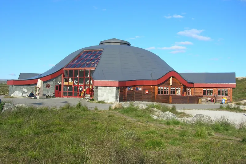
Arctic Circle Centre, Saltfjellet
On the E6 road, above the tree line, where the Arctic Circle crosses it. The nearby Saltfjellet-Svartisen National Park contains Svartisen, whose western part is the country's second-largest glacier.
All guides › Nordland · County news · What's on
Beyond the Arctic Circle: Lofoten, Vesterålen and a coast of mountains plunging into the sea.
Information checked on 10 October 2026.
On the E6 road, above the tree line, where the Arctic Circle crosses it. The nearby Saltfjellet-Svartisen National Park contains Svartisen, whose western part is the country's second-largest glacier.
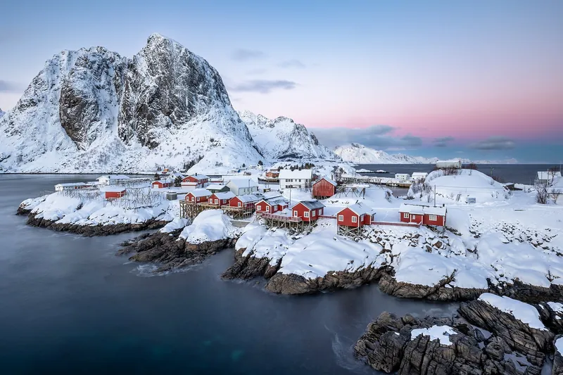
Mountains dropping into the sea, white sand beaches and fishing villages: Reine and Hamnøy, Nusfjord, Henningsvær with its football pitch on an islet. Stay in a rorbu, a fisherman's cabin on stilts. At Borg, the Lofotr Viking Museum has rebuilt the 83 m chieftain's house found on the site, the longest reconstructed Viking longhouse in the world.
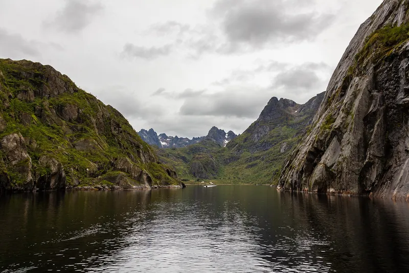
Between Lofoten and Vesterålen, a narrow 2.5 km fjord with sheer walls and an entrance barely 100 m wide. The coastal express sails in when the weather allows; boat trips also leave from Svolvær.
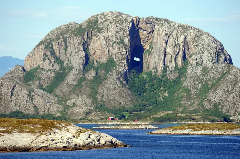
A mountain with a hole right through it, near Brønnøysund: the tunnel, about 160 m long and up to 35 m high, is reached by a 15 to 20-minute path. Legend says it was made by a troll's arrow.
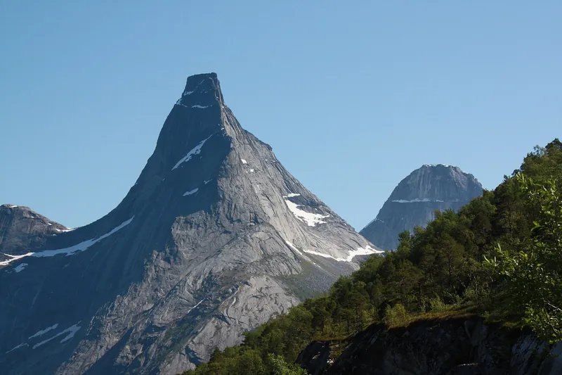
An anvil-shaped granite peak, 1,391 m, at the head of the Stefjord, an arm of the Tysfjord, voted Norway's "national mountain" in 2002. Admire it from the rest area on Route 827; climbing it is for mountaineers only.
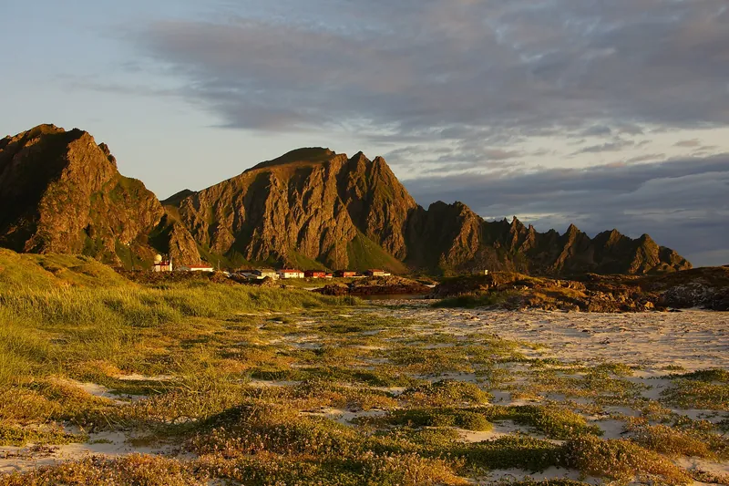
North of Lofoten, wilder and quieter islands. From Andenes, at the tip of Andøya, safaris set out all year round to the edge of the nearby continental shelf; sperm whales are seen there mainly from late May to mid-September.
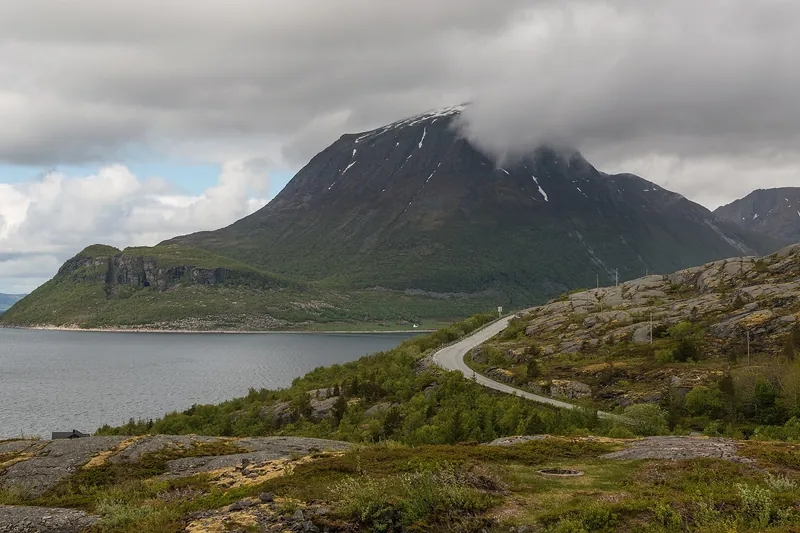
County Road 17 follows the coast for 630 km, from Steinkjer (Trøndelag) to Bodø. Between Holm and Godøystraumen, 433 km are designated as the Helgelandskysten National Tourist Route. Six ferry crossings punctuate the Nordland section: you travel at the pace of islands and fjords, so allow several days.
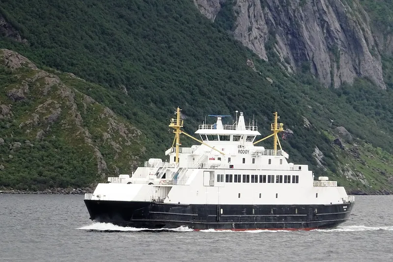
Six ferries link up County Road 17 in Nordland: Holm–Vennesund, Horn–Andalsvåg, Forvik–Tjøtta, Levang–Nesna, Kilboghamn–Jektvik, where you cross the Arctic Circle, and Ågskardet–Forøy. They cannot be booked: boarding is first come, first served, so arrive early in summer. Outside the summer season four are free for cars; Holm–Vennesund and Levang–Nesna charge fares. Timetables and prices: reisnordland.no.
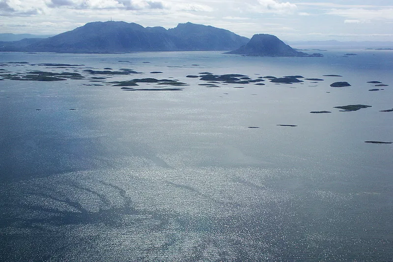
More than 6,500 islands, islets and skerries off Brønnøysund, inscribed on the UNESCO World Heritage List in 2004 for a singular tradition: islanders shelter eider ducks in small 'eider houses' and gather their down. The World Heritage Centre on Gardsøya tells the story. Ferries from Horn and Tjøtta, express boat from Brønnøysund and Sandnessjøen.
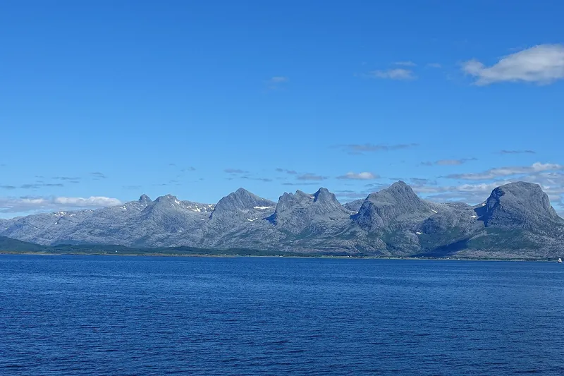
A chain of seven granite peaks on the island of Alsta, south and east of Sandnessjøen, visible from much of the coast. The highest, Botnkrona, reaches 1,072 m; the lowest, Stortinden, 910 m. Marked trails lead from the west side to each summit and link them together; more than 5,000 hikers climb them every year.
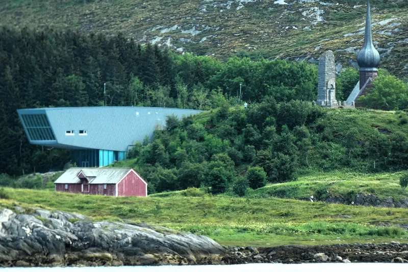
At Alstahaug, south of Sandnessjøen, a museum devoted to Petter Dass, parish priest from 1689 until his death in 1707 and author of Nordlands Trompet, a long poem describing the nature and life of the North. The Snøhetta building, opened in 2007, stands beside the old rectory and Alstahaug's stone church, completed around 1100.
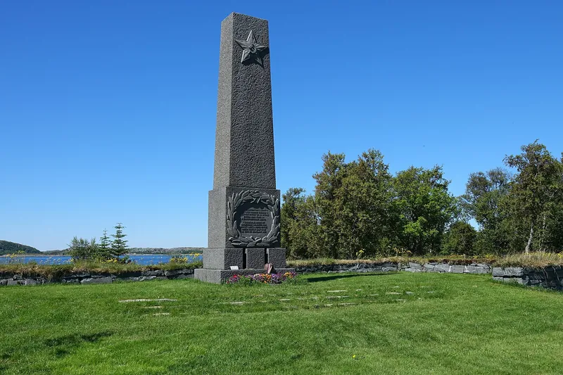
The island of Tjøtta, on County Road 17 where the ferry from Forvik lands, holds two war cemeteries where some 9,000 people lie. One gathers the Soviet prisoners of war who died in northern Norway, moved here from 1951; the other, the victims of the Rigel, a prison ship bombed by British aircraft on 27 November 1944, with an estimated 2,500 dead.
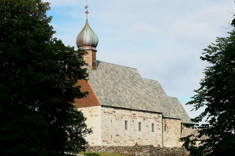
In the north of the island of Dønna, Dønnes Church, built of stone, dates from the first half of the 13th century. Built for the great neighbouring estate, it holds beneath its choir the mausoleum of the Tønder and Coldevin families. The Dønnes estate was long one of the largest in the North; Norway's first tractor went into use there in 1908.
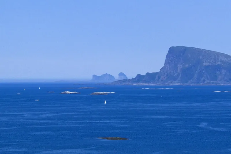
A small island in Lurøy municipality, dominated by Lovundfjellet (623 m). On its north side nests Helgeland's largest puffin colony, some 200,000 birds. They arrive in April, traditionally around the 14th, 'Lundkommardagen'. Ferry from Stokkvågen on County Road 17, and express boat from Sandnessjøen and Stokkvågen.
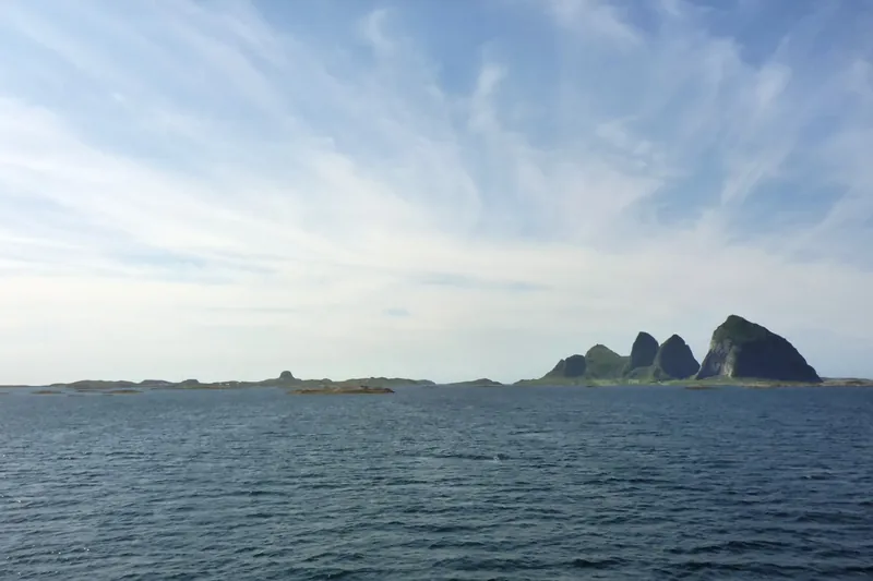
An archipelago of 477 islands, islets and skerries in the open sea, some 40 km from the mainland, near the Arctic Circle. On the island of Sanna, seventeen sea-carved caves were once inhabited, including Kirkhelleren; the oldest finds are about 9,000 years old. The Trænafestivalen is held here every July. Express boat from Nesna, Stokkvågen and Sandnessjøen, daily car ferry.
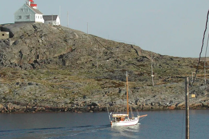
A fishing hamlet in Rødøy municipality, 32 km from the mainland, spread over some forty islands and islets; it has only about ten residents and no cars. A distillery has made single malt whisky and gin here since 2014 and presents itself as the first Arctic whisky distillery. Express boat from the mainland; in summer the coastal Bodø–Sandnessjøen route also calls here.
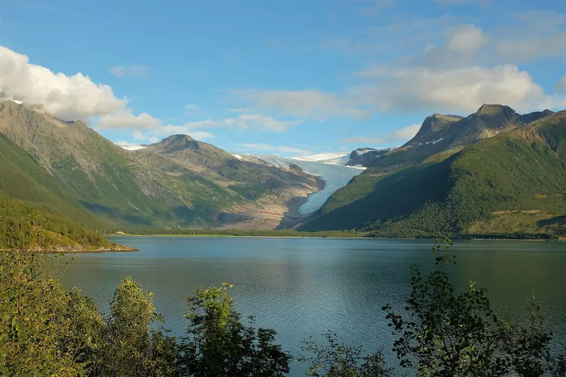
From Holandsvika, on the Fv17 in Meløy, a small boat crosses the Holandsfjord in summer; a path of about 3 km then leads to the front of Engabreen, an arm of western Svartisen, Norway's second-largest glacier, which reaches down to about 20 m above sea level. Keep at least 100 m from the ice front and never go onto the glacier without a guide.
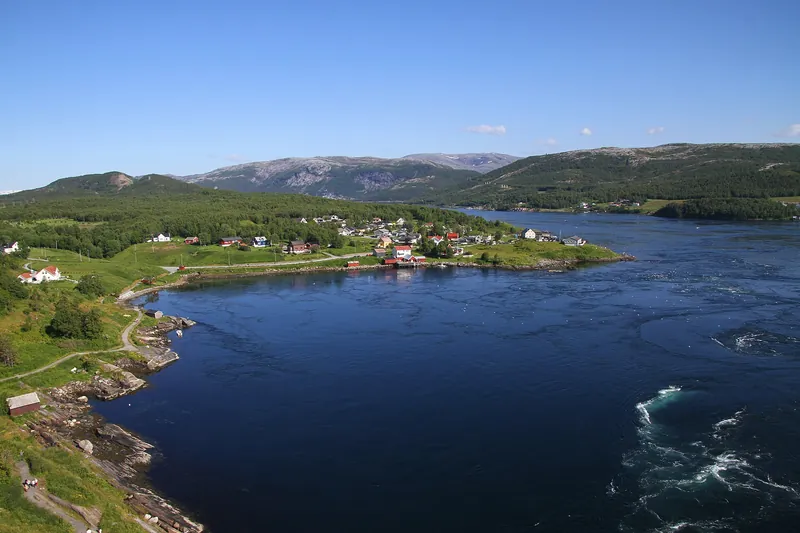
Four times a day the tide forces the sea through this 3 km strait, 150 m wide, between Saltfjorden and Skjerstadfjorden in Bodø: one of the strongest tidal currents in the world, 7 to 9 knots on average, with whirlpools around ten metres across. It runs strongest between high and low tide, especially at new and full moon, so check the tide table. The 1979 bridge gives an overall view.
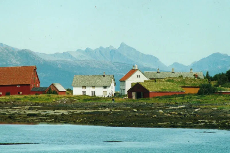
40 km north of Bodø, after the Festvåg–Misten ferry (about ten minutes), the only fully preserved trading post in Northern Norway: 15 buildings listed since 1942, with their original furnishings, run by the Nordland Museum. It was the model for Sirilund in Knut Hamsun's novels. In the village, the painter Karl Erik Harr opened his own museum in 2019.
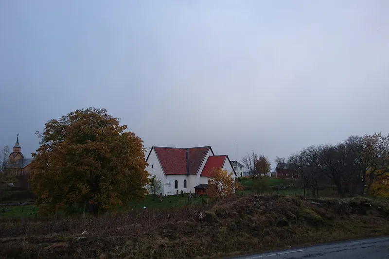
Just north of Inndyr, this stone church built of pale limestone or marble is one of the oldest in Northern Norway: around 1130 according to the Nordland Museum, around 1200 according to other sources. Left unused after the new church next door was built in 1881, then restored and reconsecrated in 1962, it forms, with the rectory and the old churchyard, a site the Nordland Museum opens in summer.
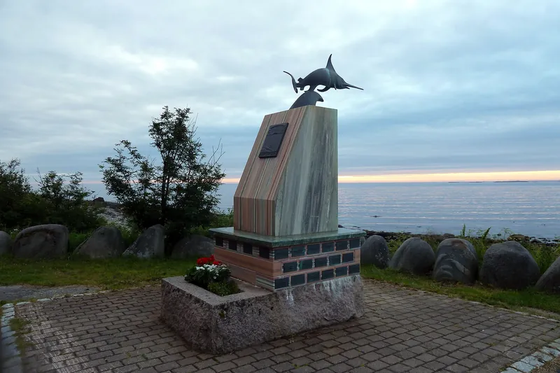
A rest area on the Helgelandskysten National Tourist Route in Gildeskål, designed by Haugen/Zohar Arkitekter: a nine-metre-wide terrace facing Fugløyfjorden, with the Lofoten wall in the distance, and toilets open all year. The memorial recalls the submarine Uredd, sunk by a mine in this fjord in February 1943 with all 42 men aboard, including agents of the Linge Company.